

The Saugatuck Reservoir Clearly Illustrates The Reason For Governor Lamont’s Drought Advisory, Which May Be Temporary
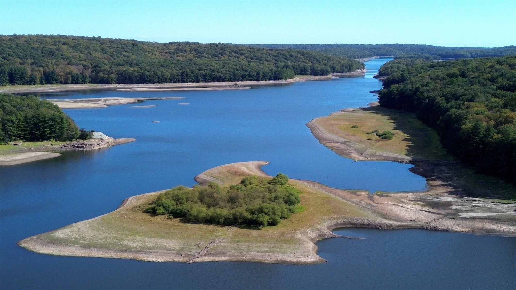
The above photo shows how depleted the water in the reservoir has become in recent years due to drought conditions prevailing in Fairfield County. Other photos show the flow of the Saugatuck as it passes through Redding alongside Route 53 which runs south to Weston and then into Norwalk. The water line in years past reached the tree line, the trees on the “island” were barely visible when the levels were high and the sand, grassy areas and rocks were usually underwater.
Photos By J.C. Martin For WestportLocalPress.com. Click on an image to enlarge and open gallery.

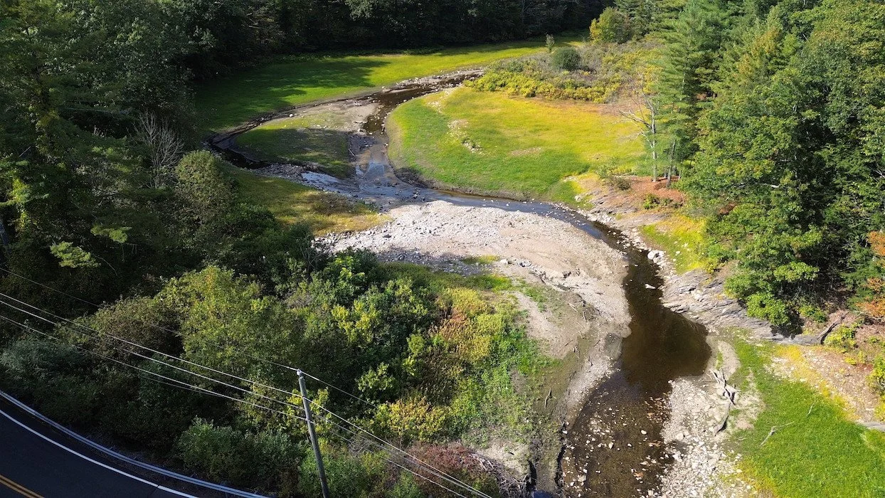
Photos above show the Saugatuck River being little more than a little stream as it flows into the reservoir.
Connecticut Governor Ned Lamont declared a Stage 2 drought advisory for Fairfield, Middlesex, and New Haven counties on October 7, 2025, due to below-average precipitation. This advisory is a step up from the Stage 1 conditions that were previously in place across the state. The Nor’Easter forecast for this week may help raise the water levels in the Reservoir, however the rise in water in the Saugatuck River often causes flooding in Westport.
A Stage 2 advisory is considered an "incipient drought" and is intended to raise public awareness of emerging drought conditions. The severity can vary by location, especially for those relying on private wells. The governor's decision was based on a recommendation from the Connecticut Interagency Drought Workgroup, following an evaluation of indicator data such as rainfall, surface water, and groundwater levels.
Drought conditions have slowed the flow of the Saugatuck in recent years. The website Snoflo.org reports the flow rate on Sunday, October 12, 2025 as being about 1 CFS, or 9% of normal. A water flow of 1 cubic feet per second (cfs) means that one cubic foot of water passes a given point every second. This is a low-to-moderate flow rate, equivalent to about 450 gallons per minute, and is considered slow-moving water for most rivers.
It remains to be seen if the current weather event will make any difference in the water level of the reservoir or the current drought conditions.
Photos By J.C. Martin For WestportLocalPress.com Click on an image to enlarge and open gallery.


The Google Earth photo (above, CENTER) shows where the Saugatuck River issues from Sugar Hollow Pond, its headwaters located at exactly 41°20'50.4"N 73°28'06.4"W[2] approximately 3 miles (5 km) southwest of downtown Danbury. Above, right shows a deeper, fuller flow as it enters into the reservoir, slowing the flow. The Saugatuck flows generally southeast, passing through the Saugatuck Reservoir (283 feet (86 m) above sea level), then turns south-southwest. In Westport, it broadens into a navigable estuary along its lower 5 miles (8 km) and enters Long Island Sound approximately 4 miles (6 km) southeast of Norwalk. Interstate 95 crosses the river near its mouth downstream from Westport center. The river is wadeable along much of its course and is a popular seasonal destination for trout fishing, with the state of Connecticut stocking the river annually.,
During the 19th century, the lower river became the site of warehouses and shipyards, as well as an important hub of maritime commerce. The town of Westport was incorporated out of the existing village of Saugatuck at the mouth of the Saugatuck River and several surrounding communities in 1835. Bridgeport Hydraulic Company Holdings (now owned by Aquarion) flooded the Saugatuck River Valley after 1938, removing the villages of Hull and Valley Forge to create the Saugatuck Reservoir.
The Samuel P. Senior dam was completed in 1941, with the reservoir filling in 1942, as stated by Wikipedia and Snoflo. he construction of the dam was the final step in a master plan envisioned by Samuel Palmer Senior for the Bridgeport Hydraulic Company, which is now the Aquarion Water Company. The Saugatuck is the largest of the eight reservoirs that make up Aquarion’s greater Bridgeport water system. It holds about 12 billion US gallons (45,000,000 m3) of water.