
Morning Weather Report: Heat Advisory; Heat Index Reaching 102 Degrees

Today - Heat Advisory 11:00 AM - 8:00 PM
A slight chance of showers before 8am, then a slight chance of showers and thunderstorms after 2pm. Mostly sunny, with a high near 91. Heat index values as high as 102. Southwest wind 5 to 9 mph. Chance of precipitation is 20%.
High Tides: 1:37 AM/2:05 PM
Low Tides: 8:07 AM/8:28PM
Tonight
A 20 percent chance of showers and thunderstorms before 2am. Partly cloudy, with a low around 73. South wind 3 to 6 mph.
Tomorrow - Heat Advisory 11:00 AM - 8:00 PM
A 20 percent chance of showers and thunderstorms after 2pm. Partly sunny, with a high near 94. Heat index values as high as 107. Southwest wind 6 to 9 mph.
Tomorrow Night
A 30 percent chance of showers and thunderstorms, mainly before midnight. Partly cloudy, with a low around 73. Southwest wind 3 to 7 mph.
Air Quality Alert from Smoke, Thunderstorm Alerts Announced by the National Weather Service
The National Weather Service, NYC has announced that “there is potential for a few strong to severe thunderstorms, with strong to damaging winds gusts, Tuesday evening ahead of an approaching cold front.”
The hazardous weather outlook includes an Air Quality Alert for the county that stands until 11:00 this evening, with smoke plumes still hovering over the community. “Fine particulates from the departing wildfire smoke plume have been slow to disperse and unhealthy levels are expected to persist throughout the day. An air quality action day means that particulate matter within the region may approach or exceed unhealthy standards. For additional information...Please visit the Connecticut Department of Environmental Protection website at http://www.ct.gov/deep/AQI:”
1.3 Million Acres Burning in the West Cause Rapid Afternoon Air Quality Drop, Haze over Westport

Smoke plumes depicted on the AirNow database late today. Wildfires in the North Western United States and South Western Canada have sent smoke plumes across the continent, clouding Westport skies and hazing over the horizons as the Interagency Wildland Fire Air Quality Response Program reported unhealthy air quality and active smoke plumes in the area, drastically increasing air pollutants throughout the day Tuesday.
During what was supposed to be a clear, sunny day in the community - the Connecticut DEEP Bridgeport air quality measurement device registered a rapid increase in the pollutants in the air over the area, jumping from just 8 micrograms per cubic meter at 8:00 AM, to 77.8 micrograms/cubic meter by 8:00 PM today.
The smoke plumes have been hovering over the tri-state area, with southern New York, northern New Jersey, and Western Connecticut experiencing the brunt of the poor air quality. According to data from the AirNow program, the smoke plume over the area is heaviest over Westport, with its outer bands reaching over Long Island and ending just prior to West Hampton.
AirNow reports that the air quality is stable, but advices high risk individuals to limit time outdoors and monitor for signs of illness. Smoke from the fires will continue for the immediate future, as over 1.3 million acres were reported as burning in the July 20th Incident Management Situation report, with the Northwest fire region accounting for 550,098 burning acres in Montana and nearby states. 19,347 fire personnel were reported as battling the blazes as of Tuesday.
Live air quality updates and smoke alerts can be found on the AirNow website.
Saturday Evening Lightning
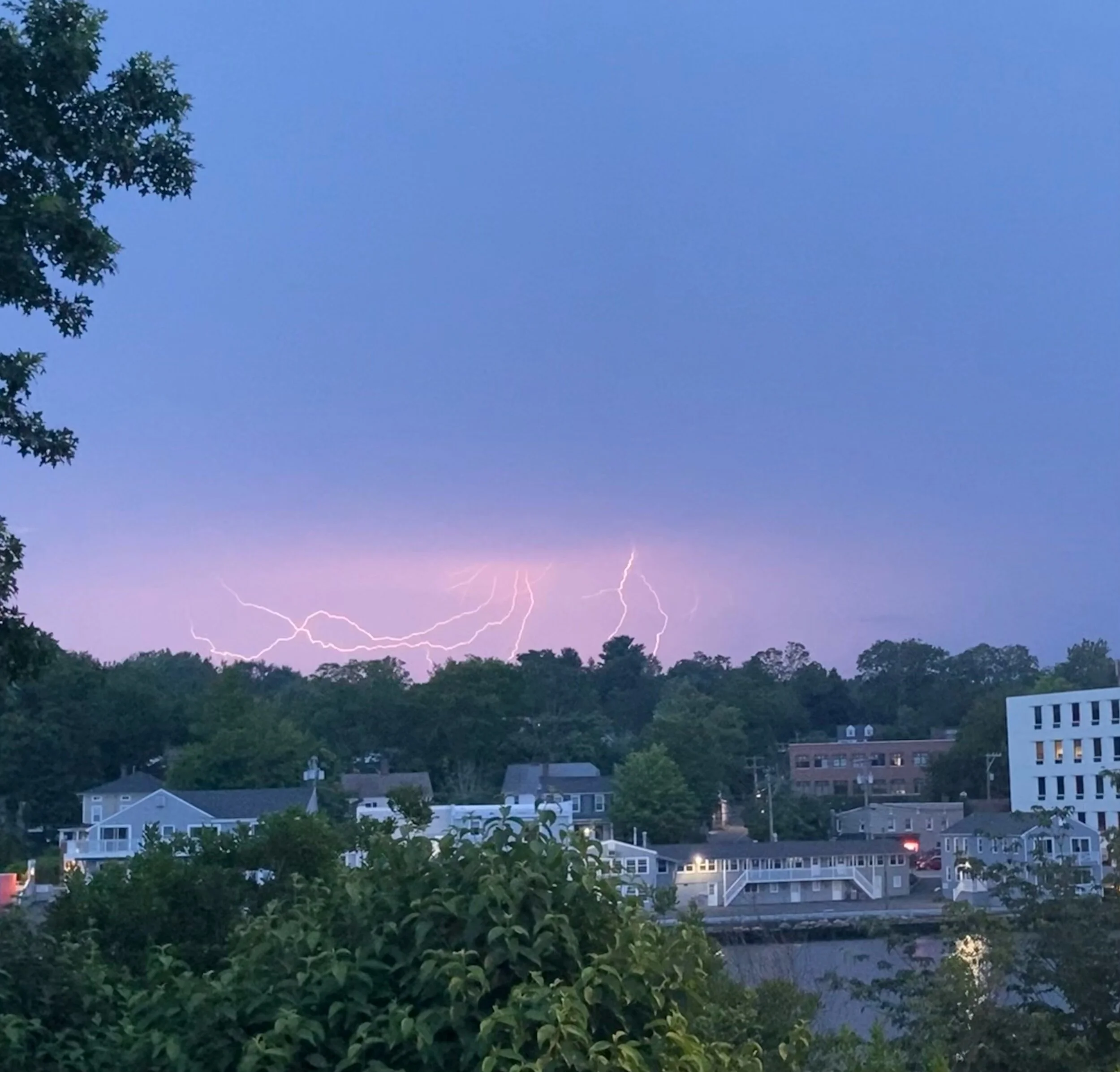
Lightning filled the skies late Saturday evening, as seen from the Levitt Pavilion. Photo by Meredith Holod for WestportLocal.com