


Morning Weather Report: Seasonal Forecast for Trick or Treating

Today
A chance of rain before 8am, then a slight chance of showers after 2pm. Mostly cloudy, with a high near 64. Southwest wind 6 to 10 mph. Chance of precipitation is 30%.
Tonight
Partly cloudy, with a low around 47. West wind around 6 mph.
Tomorrow
Sunny, with a high near 60. West wind 8 to 11 mph, with gusts as high as 22 mph.
Tomorrow Night
Increasing clouds, with a low around 42. Northwest wind around 6 mph.
Morning Weather Report: Flash Flood Watch until 5:00 PM
Today
Rain and possibly a thunderstorm. Some of the storms could produce heavy rainfall. High near 62. Breezy, with a northeast wind 14 to 20 mph, with gusts as high as 32 mph. Chance of precipitation is 100%. New precipitation amounts between 1 and 2 inches possible.
Tonight
Rain before 2am, then a chance of showers after 2am. Low around 50. Breezy, with a north wind 14 to 20 mph, with gusts as high as 34 mph. Chance of precipitation is 80%. New precipitation amounts between a quarter and half of an inch possible.
Tomorrow
A 30 percent chance of showers before 8am. Mostly cloudy, with a high near 61. Breezy, with a north wind 17 to 20 mph, with gusts as high as 32 mph.
Tomorrow Night
Partly cloudy, with a low around 43. North wind 9 to 14 mph.
Morning Weather Report: Cool, Fall Day Ahead
Today
Mostly sunny, with a high near 63. North wind 6 to 10 mph.
Tonight
Mostly clear, with a low around 46. North wind around 6 mph.
Tomorrow
Sunny, with a high near 67. Northwest wind around 7 mph.
Tomorrow Night
Clear, with a low around 49. Northwest wind 5 to 7 mph.
Morning Weather Report: Beautiful
Today
Mostly sunny, with a high near 74. Light and variable wind.
High Tides: 2:42 AM/2:51 PM
Low Tides: 8:47 AM/9:25 PM
Tonight
A 20 percent chance of showers before 2am. Mostly cloudy, then gradually becoming mostly clear, with a low around 56. Calm wind.
Tomorrow
Sunny, with a high near 73. West wind 6 to 11 mph.
Tomorrow Night
Mostly clear, with a low around 55. West wind around 7 mph.
Fairfield Avenue North Becomes More Waterfront than Originally Bargained For

Fairfield Avenue North, off of Bradley Street, remained flooded early this morning as waters in the Compo neighborhood slowly receded into nearby storm drains with the help of water pumps. The lower beach neighborhood streets experience flooding often as the hills sloping down from the shoreline trap water that settles in the lower level areas. The area falls within the Town’s AE flood zone and is described as having a 1% annual chance of flood, with the base flood elevation determined.
Blue Skies: The Difference a Few Hours Make

Westporters woke up, or paused pumping out their basements, to find brilliant blue skies and calm waters this morning after hours of historic rainfall and widespread flooding.
Local kids enjoyed a two hour delay - sleeping-in after just two mornings of waking up for the bus.
Police, Fire, and EMS personnel were busy throughout the night with motorists stuck in their cars as flash floods created dangerous situations around town - such as on Myrtle Avenue and Morningside Drive North. Several homes also experienced heavy flooding requiring the assistance of the first responders. No injuries have been reported. WestportLocal.com photo
Ida Moves in as Heaviest Bands Reach Westport

Ned Dimes Marina gives a double flag warning as Ida moves in. Editor’s Take
Some of the most dangerous bands of Hurricane Ida’s remnants are currently moving over Westchester County and the Metro New York areas - with around 3 inches of water per hour being dumped onto the area, and heavy winds and thunderstorms joining the mix.
These bands are heading towards Westport, and are expected to be over the area within the hour. They will weaken some as they move North, however rain will still be severe.
Local meteorologists have noted that although rotation in the storm is slight, the rain being dumped is signaling emergency warnings throughout the region - including the National Weather Service’s first ever Flash Flood Emergency in the New York City area. The Sherwood Island Connector is currently closed as a tree has blocked all lanes between Post Road East and Greens Farms Road (click to read full report)
Stay indoors and off of the roadways. Flooding is already being reported in some New Jersey and New York counties as “catastrophic.” Check your basements and stay away from any moving water - including large puddles, streams, rivers, and any coastal areas - as water may be deeper than it appears, with strong currents.
The storm is a long haul event, and will continue through the overnight hours. If your home floods easily, be sure items are moved to high grounds.
If you live within a heavily wooded area, consider sleeping away from windows as tree damage will be noted. Although winds will be moderate with high gusts, saturation will create an environment to allow trees to fall easily.
Schools in the region have already considered that flooding and road closures may delay the opening of buildings tomorrow.
Forecast Points:
Winds: Winds will pick up as we head towards midnight, with gusts around 30 MPH possible, and sustained winds of 10-15 MPH.
Rain: Forecasts shows 3” to 4” of rain being dumped rapidly over Westport, with most heavy rain bands moving out of the area after daybreak.
Thunderstorms: A severe thunderstorm warning has been issued until 10:30 tonight, with the storm producing lightning throughout the region - with several strikes already reported in and around Westport.
Active Weather Warnings, Advisories, and Watches:
Flash Flood Watch: Effective until 2:00 AM (possibility of flash floods)
Flash Flood Warning: Effective until 1:00 AM (presence of flash flooding)
Tornado Watch: Effective until 1:00 AM
Severe Thunderstorm Warning: Effective until 10:30 PM
Closures:
Sherwood Island Connector: Post Road - Greens Farms Road
Morning Weather Report
Today: Flash Flood Watch until 2:00 PM Thursday
Showers, with thunderstorms also possible after 11am. Some of the storms could produce gusty winds and heavy rain. High near 69. Northeast wind 3 to 7 mph. Chance of precipitation is 90%. New rainfall amounts between a half and three quarters of an inch possible.
High Tides: 7:39 AM/7:53 PM
Low Tides: 1:36 AM/1:44 PM
Tonight
Showers and possibly a thunderstorm. Some of the storms could produce gusty winds and heavy rain. Low around 61. Northeast wind 9 to 15 mph. Chance of precipitation is 100%. New rainfall amounts between 3 and 4 inches possible.
Tomorrow
Showers likely, mainly before 11am. The rain could be heavy at times. Cloudy, then gradually becoming mostly sunny, with a high near 72. North wind 14 to 16 mph, with gusts as high as 29 mph. Chance of precipitation is 60%. New precipitation amounts between three quarters and one inch possible.
Tomorrow Night
Partly cloudy, with a low around 55. North wind around 11 mph, with gusts as high as 25 mph.
Westport Emergency Operation Center Closes: “Hurricane Henri is behind the Town of Westport.”
From the Town of Westport Emergency Operation Center
As many of you know, the major effects of Hurricane Henri were felt in the Eastern part of Connecticut and Rhode Island, and the impact on Westport has been relatively limited. We had very few power outages today, all of which Eversource quickly resolved. I am pleased to report that Hurricane Henri is behind the Town of Westport. As of 4:30pm, we closed the Town’s Emergency Operations Center.
While we will continue to see rain and winds, the overnight storm impacts to Westport are expected to be less serious than previously projected. Unrelated to Hurricane Henri, thunderstorms are expected throughout Connecticut tomorrow.
I want to thank our residents and businesses for heeding the instructions to remain at home and prepare for what could’ve been a major situation. I hope that for many Westporters, today was a day well-spent with family, or at least a chance to test and improve your emergency preparedness.
Thank you also to the Westport Fire, Police, Public Health, Parks & Recreation, Public Works, and Human Services Departments for their efforts to monitor and prepare to respond to the needs of our community.
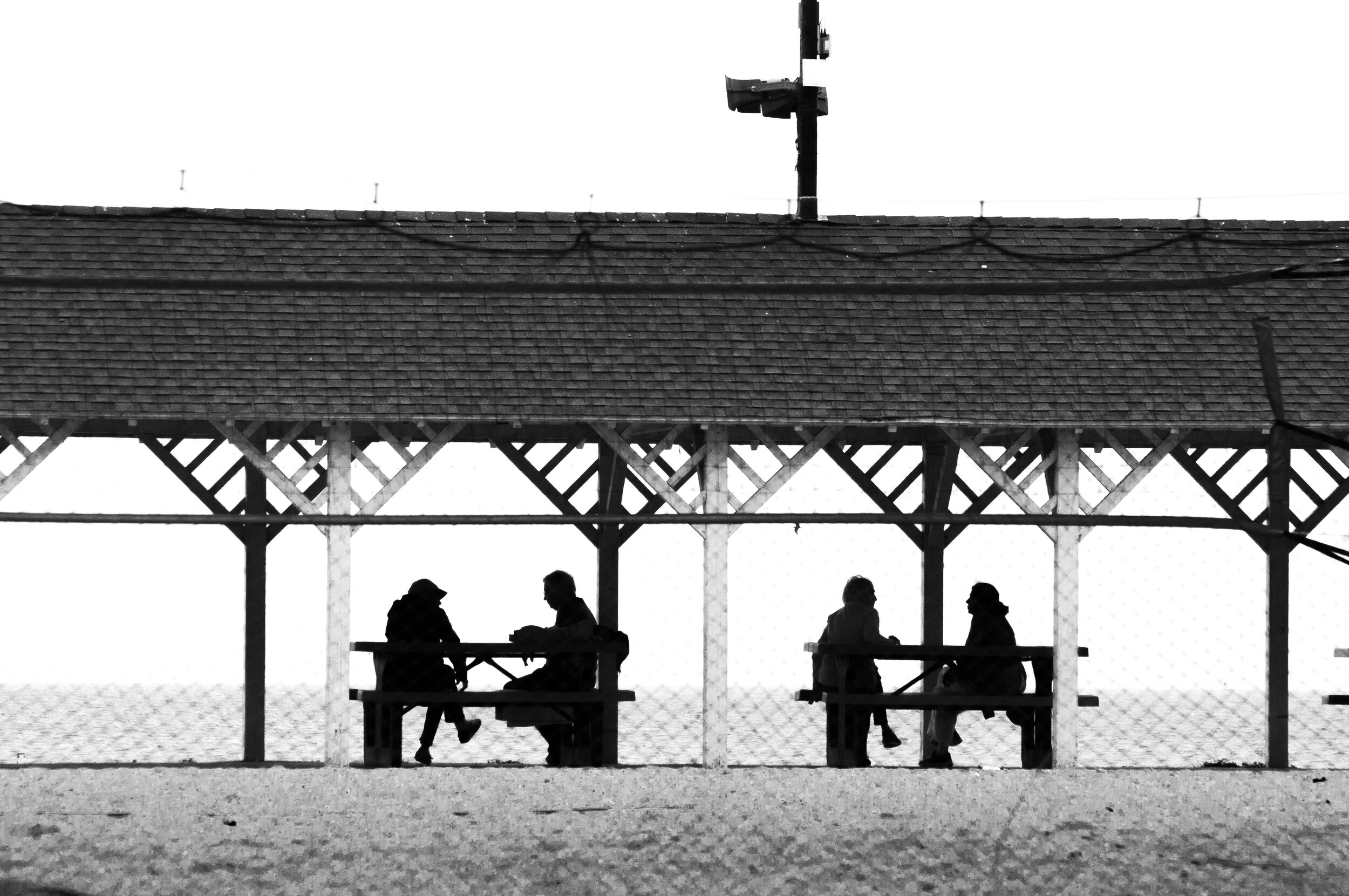
Enjoying the Day Off
With many stores closed and schedules cleared ahead of the forecast storm, many community members enjoyed the newfound time-off as Westport escaped Henri’s damaging winds and storm surges that are battering the northeast. Compo Beach was busy with pedestrians earlier in the day as the skies were calm for several hours, with the historic pavilion sheltering friends from the midday drizzle. WestportLocal.com photo